Durham Public Schools Address Validation & Enrichment Project
Spring 2026
Durham Public Schools have an ongoing need for reliable, accurate student address geocoding. The data changes frequently, and inaccuracies in updates can cause issues with bus routes. They have limited resources and a growing need for accurate geocoding workflows in the dynamic student data.
Problem Statement
There are three primary project goals:
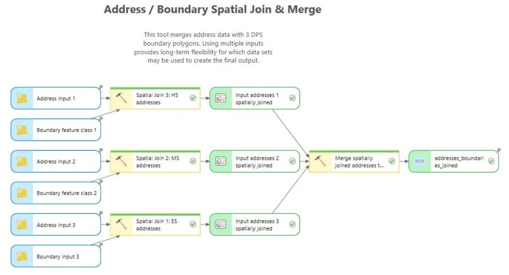
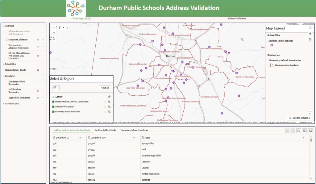
Design a process to spatially join Durham County Open Data Active Addresses into DPS school boundaries. This is needed to create and constrain new student registrations so users can select addresses from a drop down, rather than typing in their own address.
Develop a process to compare Durham County Open Data Active Addresses with Durham County Open Data Roads data and TIMS roads data to make sure all possible addresses are covered by roads data.
Build on previously developed processes to geocode all addresses using Durham County Open Data Active Addresses, NC OneMap Addresses, and potentially Durham County Open Data Roads data, save all matched addresses w/ lat/long in a .csv file and feature class, and export all unmatched addresses into a .csv file.
Methods
The technical approach used in this project was to evaluate the student data and public address data used by Durham Public Schools, develop models to perform the required processing tasks and create enriched address data output for use in reporting and district planning.
Previous capstone projects addressed the fundamental geocoding issue, providing a Python script tool to Durham Public Schools that matched addresses and output two files: matched and unmatched. However, this script creates a new locator each time it runs. The modification requested is to have a tool that can run locally on the data sets, without relying on a Python script for the output. This project will build on that and provide a more refined geocoding solution in either a web-based interface or an ArcPro map package with built in tools and data for a user to run locally.
Results
Reflection
This project gave me the opportunity to work with address data in new ways. I built a custom geolocator for the first time and explored the ways to customize that tool to the project needs. Through my weekly client meetings, I was able to better understand and refine the client needs and work through challenges together. I developed several models so they have flexibility in their processes, and I provided the custom locator they need to geolocate addresses without consuming ESRI credits.
I learned new dimensions of address data and creating custom locators and tools that I didn’t know before this project. I also gained improved understanding of data modeling and organization. These are skills that are immediately applicable in my work, and across future projects.
